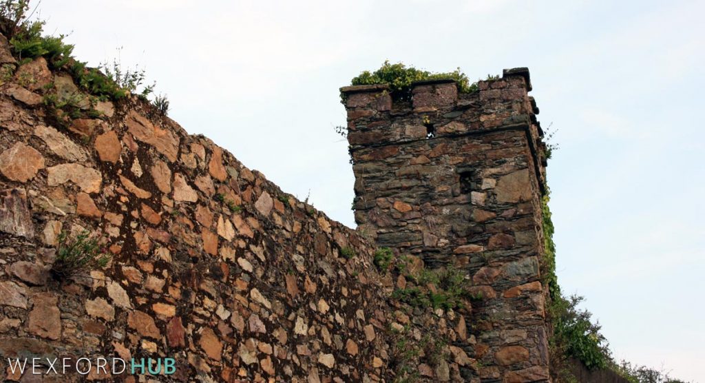
Wexford’s Town Wall
Construction of Wexford’s town wall began in the early 1200s after the 1169 Norman invasion. The wall enclosed approximately 25 hectares.
A collection of photographs featuring local streets, historical sites, and notable places to visit.
Construction of Wexford’s town wall began in the early 1200s after the 1169 Norman invasion. The wall enclosed approximately 25 hectares.
Rowe Street runs from John Street to North Main Street. It is best known as the location of the Church of the Immaculate Conception and St John.
Hill Street in Wexford Town was once called Cabbage Row. In 1932, residents voted against renaming it after Sean McDermott.
Trinity Street in Wexford Town was named after a Norse-Irish church, likely dismantled to repair Wexford Castle after the 1649 Cromwellian sack of the town.
Temperance Row takes its name from a temperance hall built following Father Theobald Mathew’s 1840 visit to the town. The street was also historically known as Cowgate Street, Le Cowstrette, and Hey Bey.
An RTÉ Archives news report from 1981 documents Wexford Town’s economic difficulties during the 1980s recession, with footage of local factories and streets.
Oyster Lane in Wexford Town was the centre of the medieval oyster trade. A 1974 excavation uncovered over 900 potsherds, including fragments of French pottery that pointed to trade between medieval Wexford and France.
Carrigeen Street in Wexford Town runs from Grogan’s Road to the Bride Street junction along a rocky outcrop. Its Irish name ‘Carraigín’ means ‘little rock.’
Grogan’s Road in Wexford Town was home to a fever hospital that treated cholera patients during the 1832 epidemic, traced to the Bengal region of India.
Bride Street in Wexford Town takes its name from the old parish of St Bridget. Archaeological excavations uncovered 15 post and wattle houses dating from the 11th to 14th centuries and a Viking bone pendant from 1000 AD.