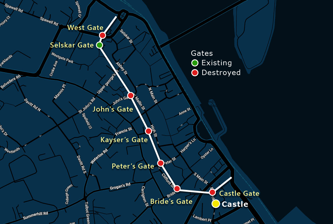
In the decades following the 1169 Norman invasion, a medieval stone fortification was raised around Wexford. Enclosing roughly 25 hectares, this 1.2-kilometer wall stretched from West Gate and Selskar Abbey to the site of Wexford Castle on Barrack Street. Rather than a full ring, the defences formed a distinctive C-shaped circuit, as the town’s seaward side was unfortified.
The suburbs are thought to have been located outside the walls in what is now the Faythe area. The circuit enclosed five parishes: Doologe, Mary, Patrick, Iberius, and Selskar, whose names reflect the Irish, Norse, and Norman origins of the town.

Construction
Construction is presumed to have begun in the early 1200s and likely took roughly 50 years to complete, based on comparisons with similar walls elsewhere in Ireland.
Wexford, whose name is derived from the Norse word “Waesfiord,” meaning “broad shallow bay,” was founded as a Norse settlement. Viking activity in the harbour was first recorded in AD 819.
When the Anglo-Normans reached Wexford in 1169, the town already had some form of wall. Giraldus Cambrensis (Gerald of Wales) wrote that the Ostmen inhabitants (Norse-Irish) burnt the suburbs and withdrew inside a wall protected by a ditch or moat.
Archaeological excavations uncovered evidence of ditches and banks that predate the Norman occupation.
These finds suggest the Viking town was surrounded by an earthen embankment faced with a stone retaining wall, further protected by a trench that was topped with a wooden palisade. Archaeologists have discovered similar earthen defences in Dublin, Waterford, and Limerick.
The Norman stone wall that exists today is thought to have followed the line of the earlier Viking defences in the southern parts of the town.
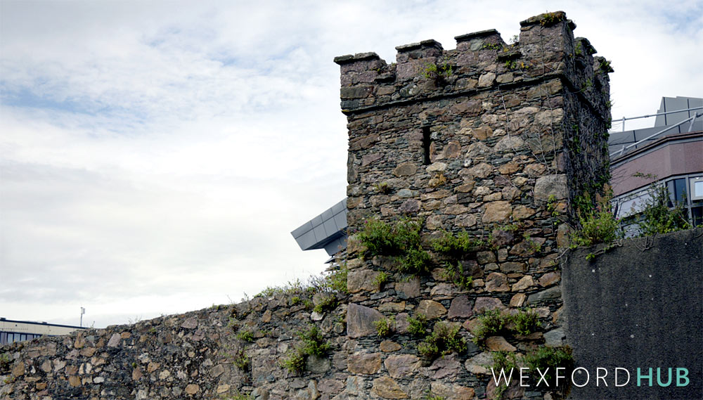
The wall is constructed of random angular rubble limestone. An 1851 account describes it as about 4.5 feet (1.4 m) thick and 22 feet (6.7 m) high, though the height varies at points.
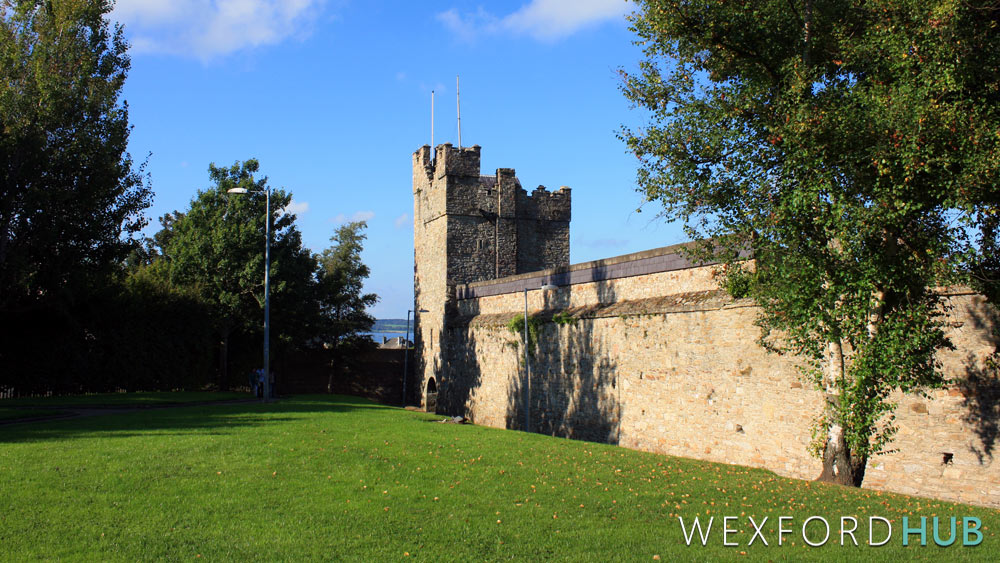
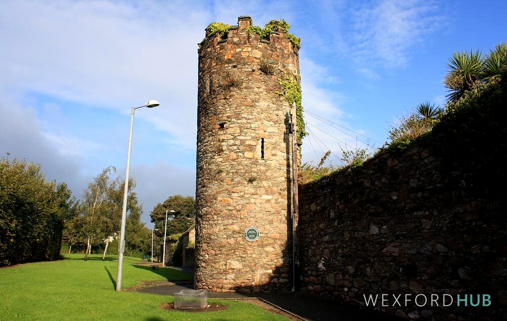
It originally had five towers, two round and three square, with flights of steps leading to the parapets (walkways at the top).
Earlier towers were rectangular, while later ones were cylindrical. The presence of both styles in Wexford indicates that construction took place over a lengthy period.
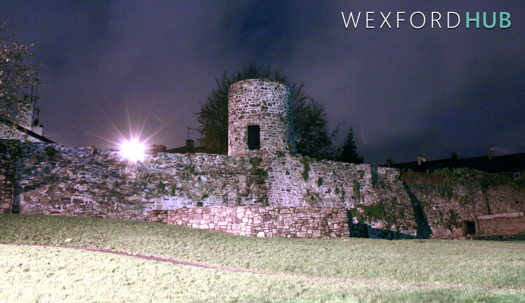
The section from Abbey Street to Selskar Abbey has cylindrical towers and is thought to have been built later.
Gates
Access to the walled town was controlled by six defended gates: West Gate (also called Cow Gate), John’s Gate, Kayser’s Gate (also known as Friar’s Gate or Raby’s Gate), Peter’s Gate, Bride’s Gate, and Castle Gate.
A seventh, private gate stood at Selskar Abbey.
According to one account from the archives, Sir Stephen Devereux placed his arms over West Gate along with an inscription from Psalm 127, which read, “Except the lord keep the city, the watchman waketh in vain.” It is believed that King John started the wall and that Devereux finished it in the 1300s.
A parliamentary inquiry held in Selskar Abbey in 1462-63, during the reign of Edward IV, recorded that the town was “spacious within the walls, which requires great repair and costs.”
Maintaining the town walls caused a divide between the northern and southern halves of the town, as each side had to pay for its own section. The south, however, was able to raise more revenue. The inquiry recommended that both sides combine their revenue and carry out maintenance without preference for either part.
A toll was introduced in 1537 to help pay for repairs to the town’s defences. That same year, a petition to the king stated that the town “lies open on one side and sustains great damage.” The letter asked to be excused from paying rent so that the money could instead be used to restore the walls.
Oliver Cromwell
During the Rebellion of 1641, when Wexford served as a chief port of the Confederate forces, the citizens strengthened the wall by building a 16-21 feet earthen rampart outside the most vulnerable sections.
Records from the time indicate that they “entrenched the town wall,” and made an 8-foot clearance along the inside.
In October 1649, Oliver Cromwell besieged Wexford. He described the town as “pleasantly seated and strong, having a rampart of earth within the wall nearly 15 feet thick.”
During the siege, Cromwell’s artillery severely damaged the town wall.
A property document from 1666 mentions a “thatched house upon the town wall,” indicating that dwellings had been built upon the fortifications.
Removal of the gates
By the 18th century the gates had become obstructions to traffic. All six were taken down in 1759. Although they were re-erected in a plainer manner after the 1798 Rebellion, historian George Henry Bassett later recorded that the new wooden gates were “so light that children could close them.”
The Wexford Corporation removed the gates again in 1835.
In 1852 a large square tower at the corner of Rowe Street was demolished to increase space and provide more light to the chancel window of Rowe Street Church.
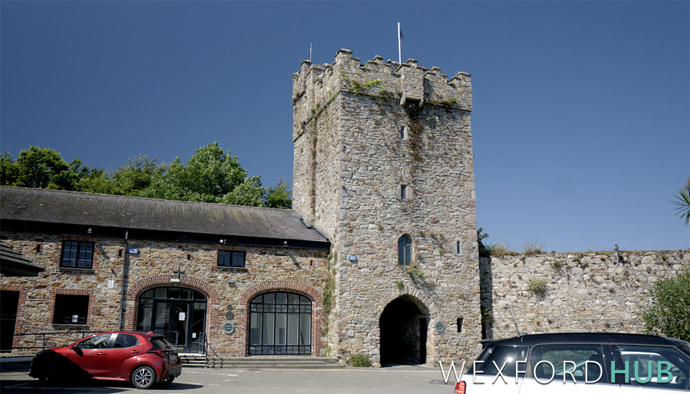
About two-thirds of the original wall survives today, though the condition varies along its length. The best publicly accessible examples include the restored West Gate Tower (originally Selskar Gate) and the adjoining stretch of wall leading to George’s Street. Another notable section is located off Abbey Street.
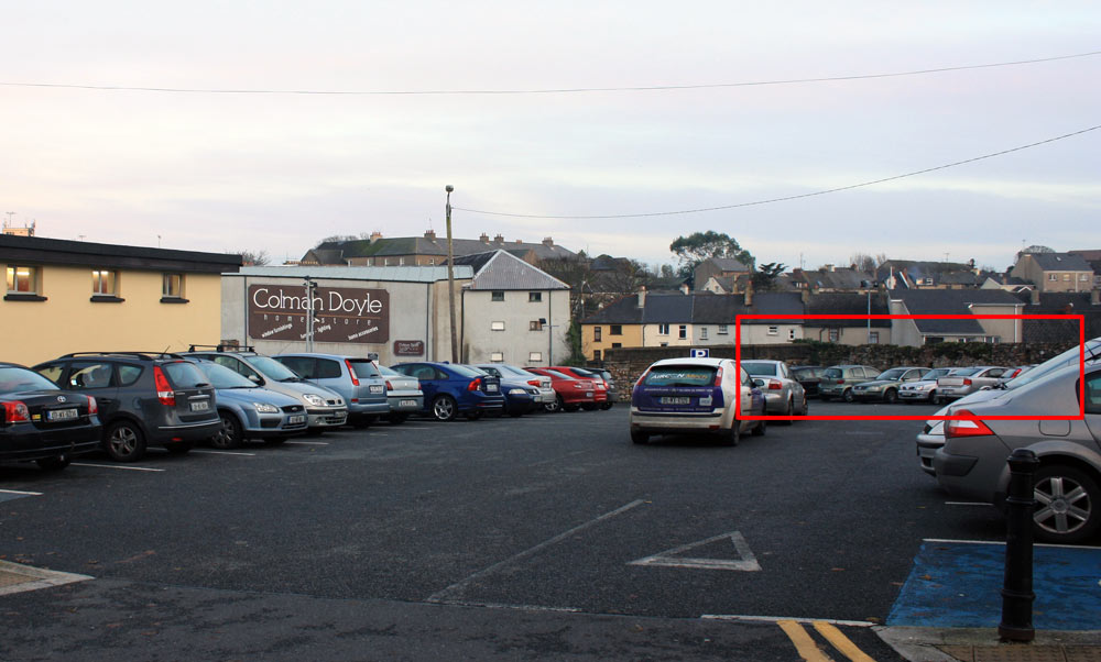
The car park of Rowe Street Church contains a surviving length with a square tower.
Part of the wall forms the boundary of St Patrick’s Church on High Street. Sections are also visible in the car parks at Bride Street and The Ropewalk.
Conservation work in recent decades has focused on preserving rather than restoring the wall. The West Gate Tower was restored in the 1980s, and the Abbey Street tower in the 1990s. The Abbey Street section was repaired using traditional lime mortar instead of modern cement, helping to preserve the wall using materials that are closer to those originally used.