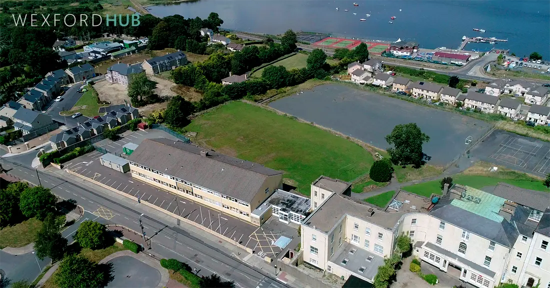
Spawell Road is a 1 km stretch in Wexford Town running from Carcur to the roundabout at the bottom of Hill Street. It is notable for Redmond Park and the redbrick homes of Glena Terrace, as well as being the former site of Loreto Secondary School, which relocated to Ballynagee in 2018.
The street’s name originates from an old spa well that once stood near Westgate, close to building now housing The Old Granary restaurant. Locally, the well was referred to as “the Spa.” According to Philip Herbert Hore’s History of Town and County of Wexford, the area was referred to as Whitewell in 1650.
One of the most striking parts of Spawell Road is Glena Terrace, a row of eight redbrick three-storey houses.

The houses were built by Mary O’Connor in 1892. A building contractor by trade, she took over her husband’s practice after his death. Over the years, she made several significant contributions to the architecture of Wexford Town.

An Ordnance Survey map from 1882 highlights five wells and several notable buildings in the area.
Strandfield House, constructed in the mid-1700s, is situated within the Strandfield Manor housing estate.

Spa Well Mills stood on what is now the front half of Redmond Park. It was also known as Howard Rowe’s Flour Mill and, before that, Scallan’s Brewery.

Other entries on the map include Riverview Terrace, Lorne Villa, Tivoli Terrace, and Carcur House, all of which are still in existence.
The map also lists Wellington Cottage and the Loretto Convent, which later became the site of Loreto Secondary School.
Today, the road is home to several housing estates, including Priory Court, Richmond Terrace, Spawell Crescent, and Spawell Lane.

Wexford Gaol was used as a prison until the early 1900s. The women’s prison and the front gates of the surrounding grounds are still intact. Later, it was converted into St. Brigid’s Centre, an alcoholism treatment centre. The area became known as St. Brigid’s Road during the 1910s, likely due to this association. The street was also known locally as the Jail Road.

On 2 October 1649, Oliver Cromwell and his New Model Army arrived at the outskirts of Wexford Town. During the first day of the siege, Cromwell’s army set up camp in this area before eventually circling around the outskirts and relocating to Trespan Rock on the southern side of the wall.

Map
A map showing its location: