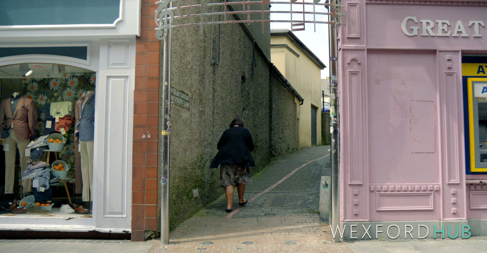
Keyser’s Lane runs from Wexford’s High Street to the car park on Crescent Quay.
Dating back to Norse times, it once separated the old parish boundaries of St. Patrick’s and St. Iberius’. The eastern half of the lane now passes under a small archway on South Main Street.

An embossed metal sign above the archway reads as follows:
The name Keyser’s Lane appears in the Norse towns of Wexford, Waterford and Dublin. In 1575, Holinshed’s Dublin Chronicles is found speculating as to its long forgotten origin. These Keyser streets ran steeply down to the Norse waterfront. The name, in saga Norse, appears to mean ‘the street of the ship wharfs’.
The name also appears as Keyser’s Hill in Cork and as Keyser’s Lane (now Highlanes) in Drogheda, extending its reach beyond the Norse towns listed on the sign.
Historians dispute the meaning of the name. While some sources interpret it as “lane to the quay” or “street of the ship wharves,” the prevailing historical view derives Keyser from the Old Norse “keisa” (meaning “bend” or “lane”) or “keisari” (“emperor”).
The western part of Keyser’s Lane lies on the opposite side of South Main Street. Before the car park on High Street was created, this section contained houses, most occupied by families of military personnel.
Locals refer to the eastern side (archway) as Slegg’s Lane, and sometimes as Cromwell’s Lane. Cromwell’s Lane may refer to nearby Kenny’s Hall, where historians believe Cromwell stayed after the sack of Wexford.